Graveyard Fields & Upper Falls – Home – Parks & Forests – Camping – Hiking – Links – Adventures
Graveyard Fields & Upper Falls
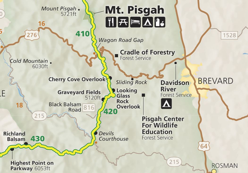
Graveyard Fields, about 25 miles south of Asheville, is one of the more popular recreation areas on the Blue Ridge Parkway (Milepost 418.8). It provides an overlook of a small valley and 6,000-foot peaks beyond, hikes to two waterfalls and Pisgah National Forest trails to spots on the Yellowstone Prong river that are favored warm-weather hangouts for locals.
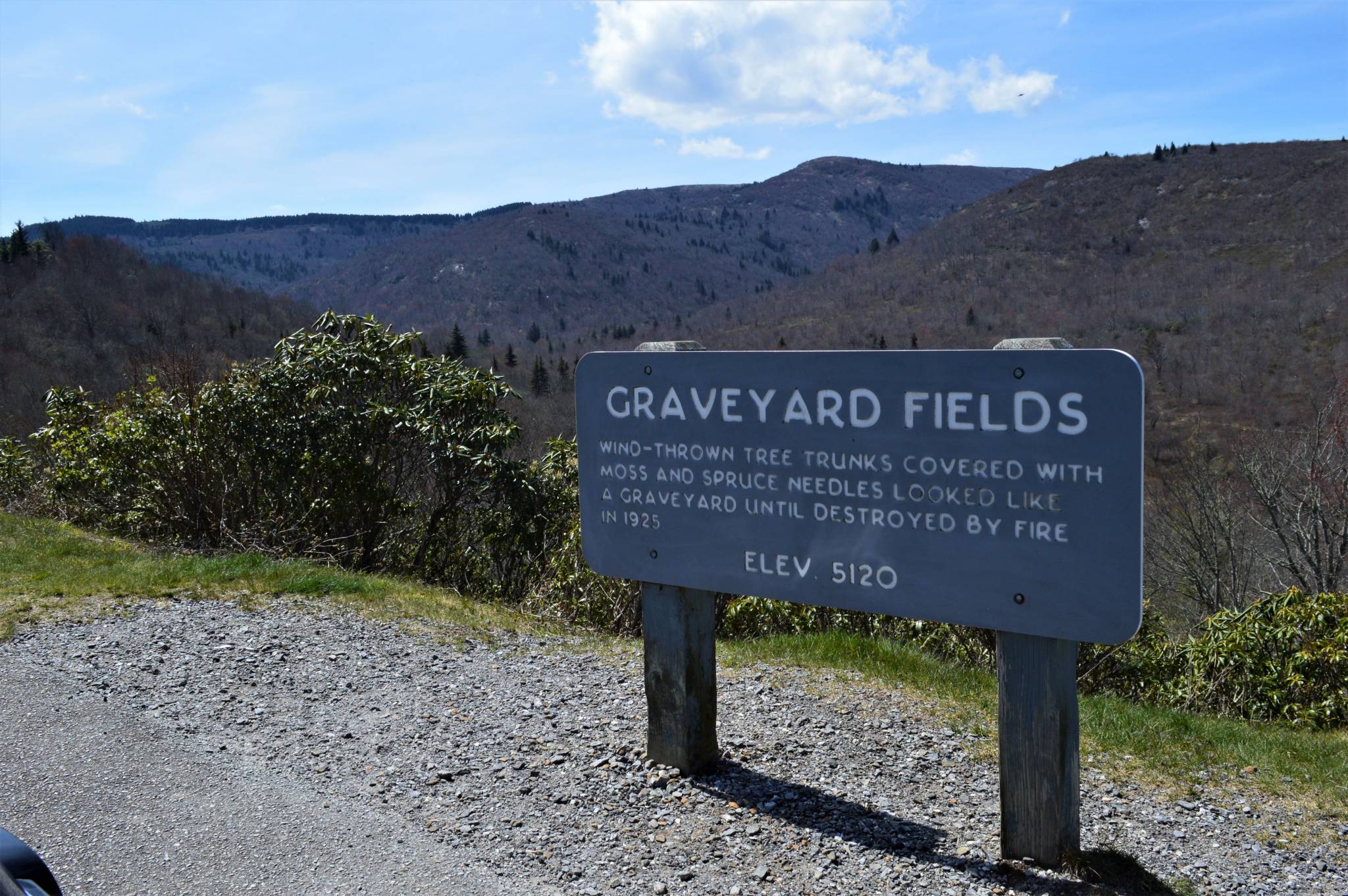
The valley is called Graveyard Fields because, after a sudden wind toppled trees several hundred years ago, the tree trunks left behind looked like headstones. In 1925, a fire burned the recently logged area, and the forest has yet to grow back fully.
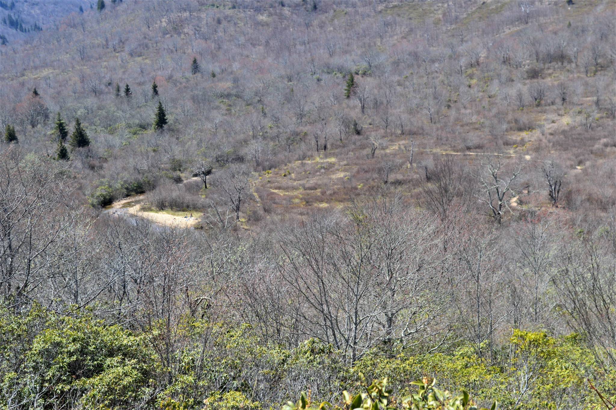
From the overlook, you can see some trail and one of the rocky beaches on the river that draw locals.
We visited Graveyard Fields on a Monday at the end of April 2021, a day after finding the parking lot overflowing the two times we passed it. The U.S. Forest Service has plans to create an additional access from the Parkway’s John Rock Overlook at MP 219.
Graveyard Fields Waterfall Hike
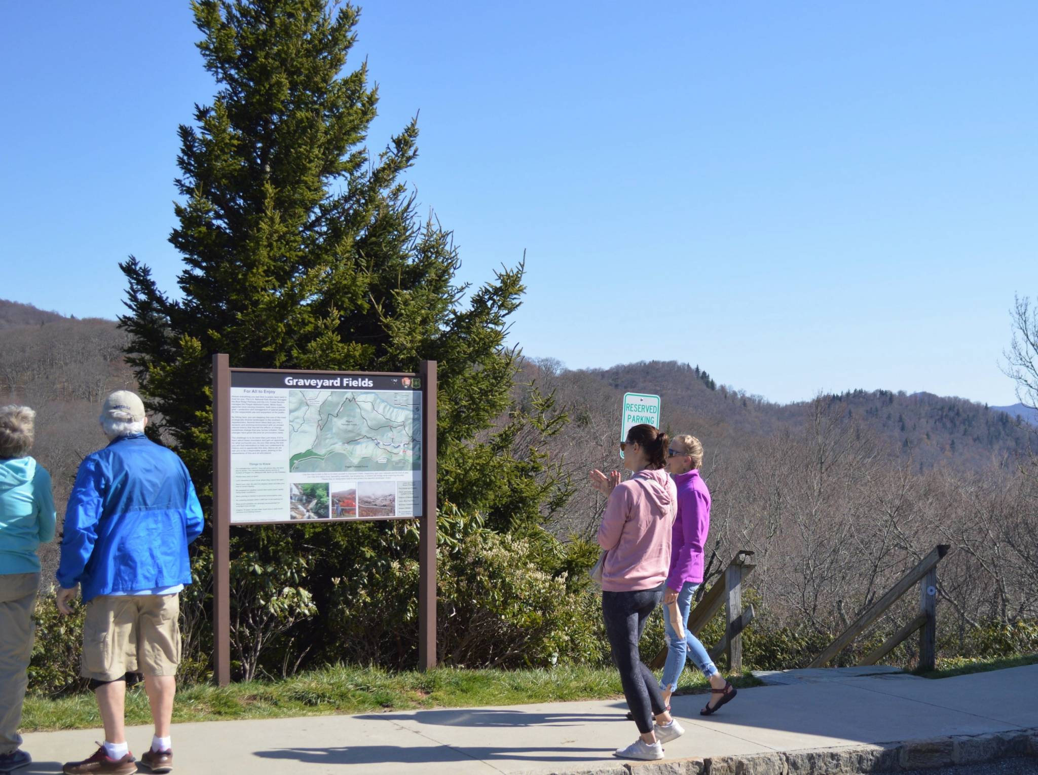
The 3.2-mile Graveyard Fields Loop Trail has trailheads at either end of the Parkway overlook parking lot. The easier hike is a 0.3-mile partially paved walk to Second Falls, which makes the overlook (which also has vault toilets) very popular with tourists.
Starting from the northern end of the parking lot, near the restrooms, and heading down the stairs, the trail is paved as it heads through a section of rhododendron toward the river.
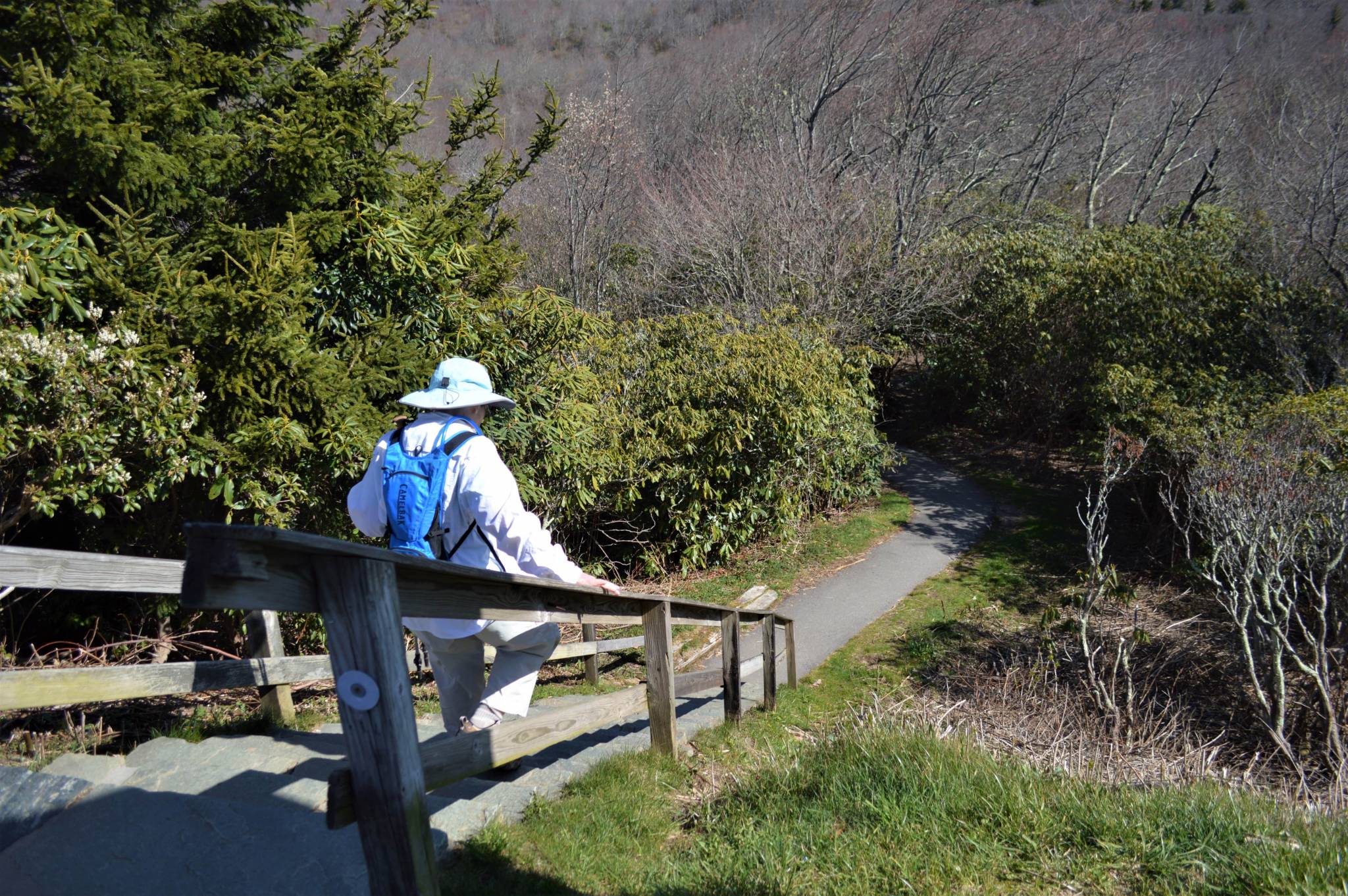 Quickly, wooden stairs lead to a platform and bridge across the river, where it’s easy to get onto the rocks and see the stream.
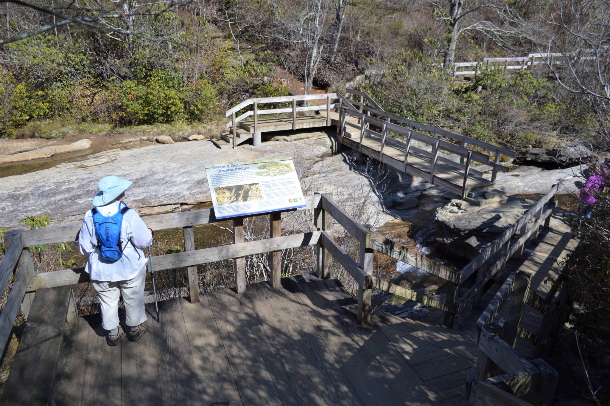
Across the river, the trail splits, with Second Falls to the right and the Loop Trail continuing to the left. Somehow, we blanked on the fact that a waterfall we came to see was to the right, and took a left. The spur trail to the right includes a 60-step wooden stairway to a platform at the base of the falls, according to the National Forest Service description of the trail. The Blue Ridge Parkway Association has a nice photo of Second Falls, also called Lower Falls.
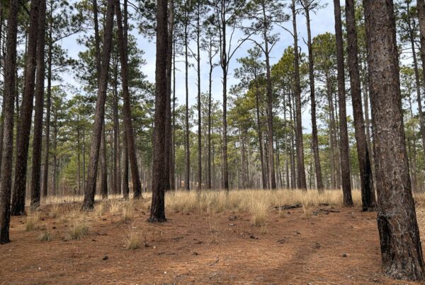
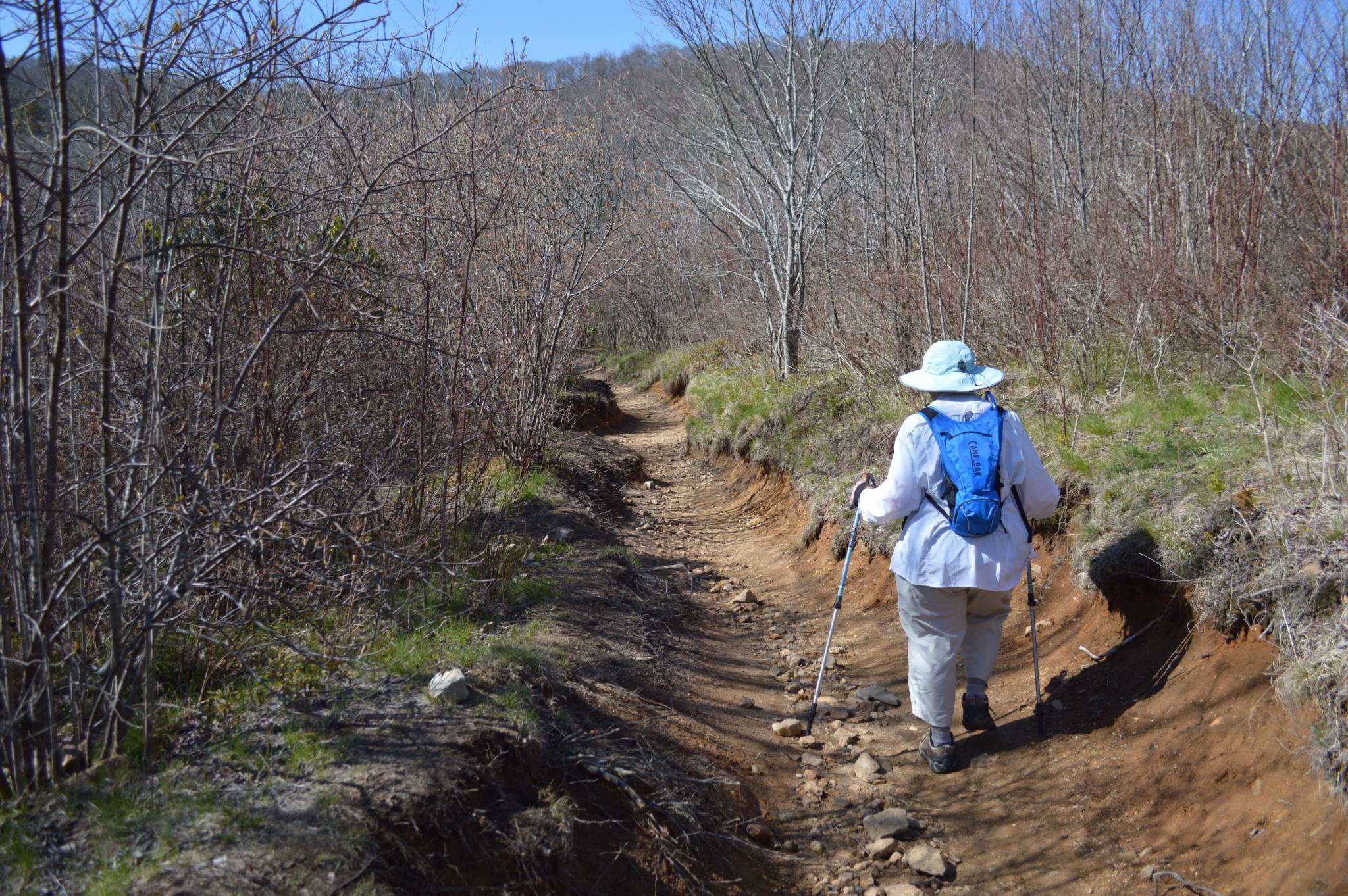
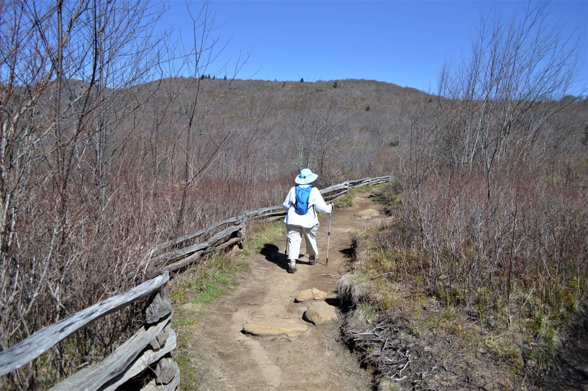
 The Loop alternates through forested areas and open areas of grasses and blueberries as it meanders back toward the stream. In some places, the trail is a red-dirt rut and in other places it flattens.
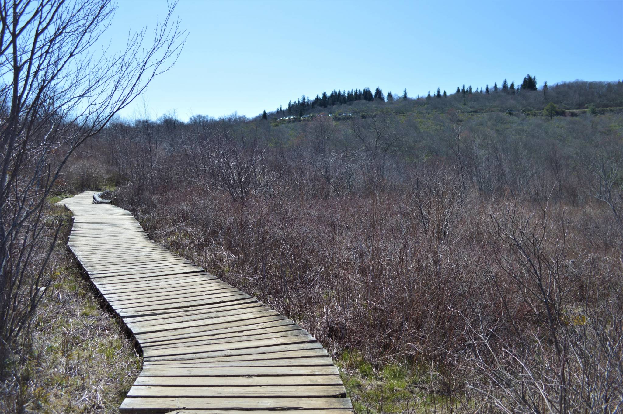
Looking back on a stretch of boardwalk, the overlook parking lot can be seen above.
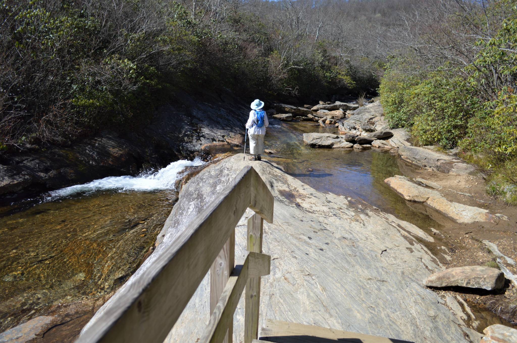
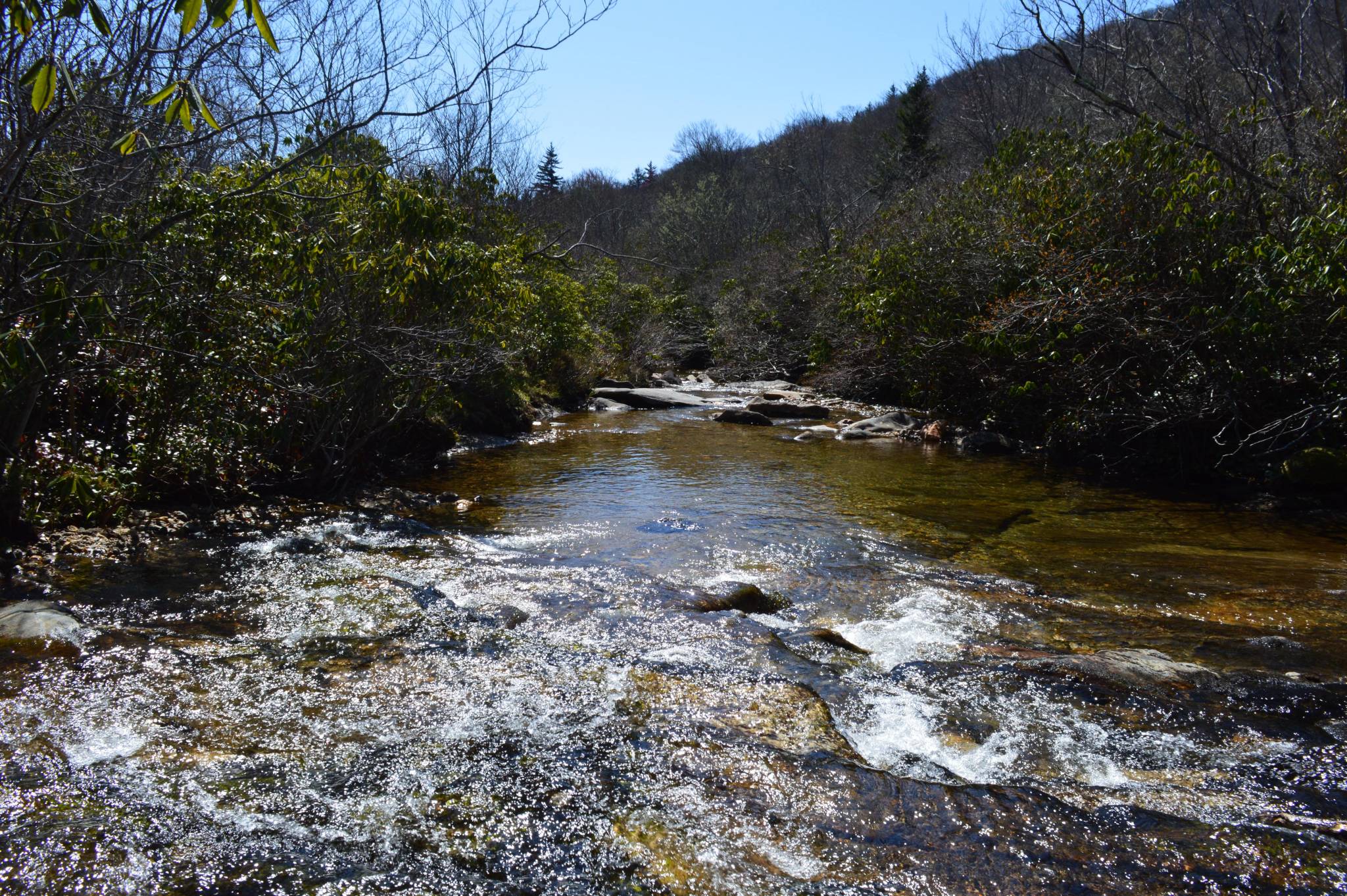
As you continue along the loop, look for side trails to the Yellowstone Prong River to catch some pretty scenes.
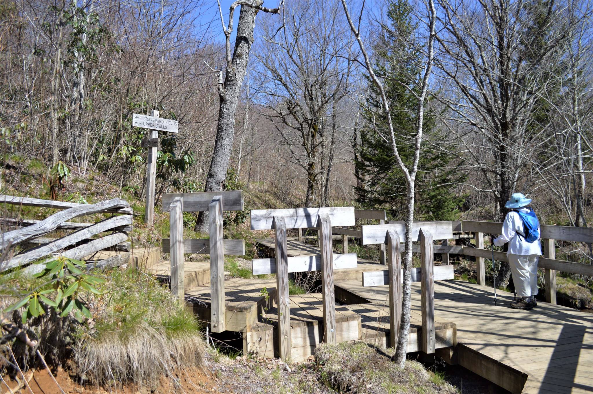
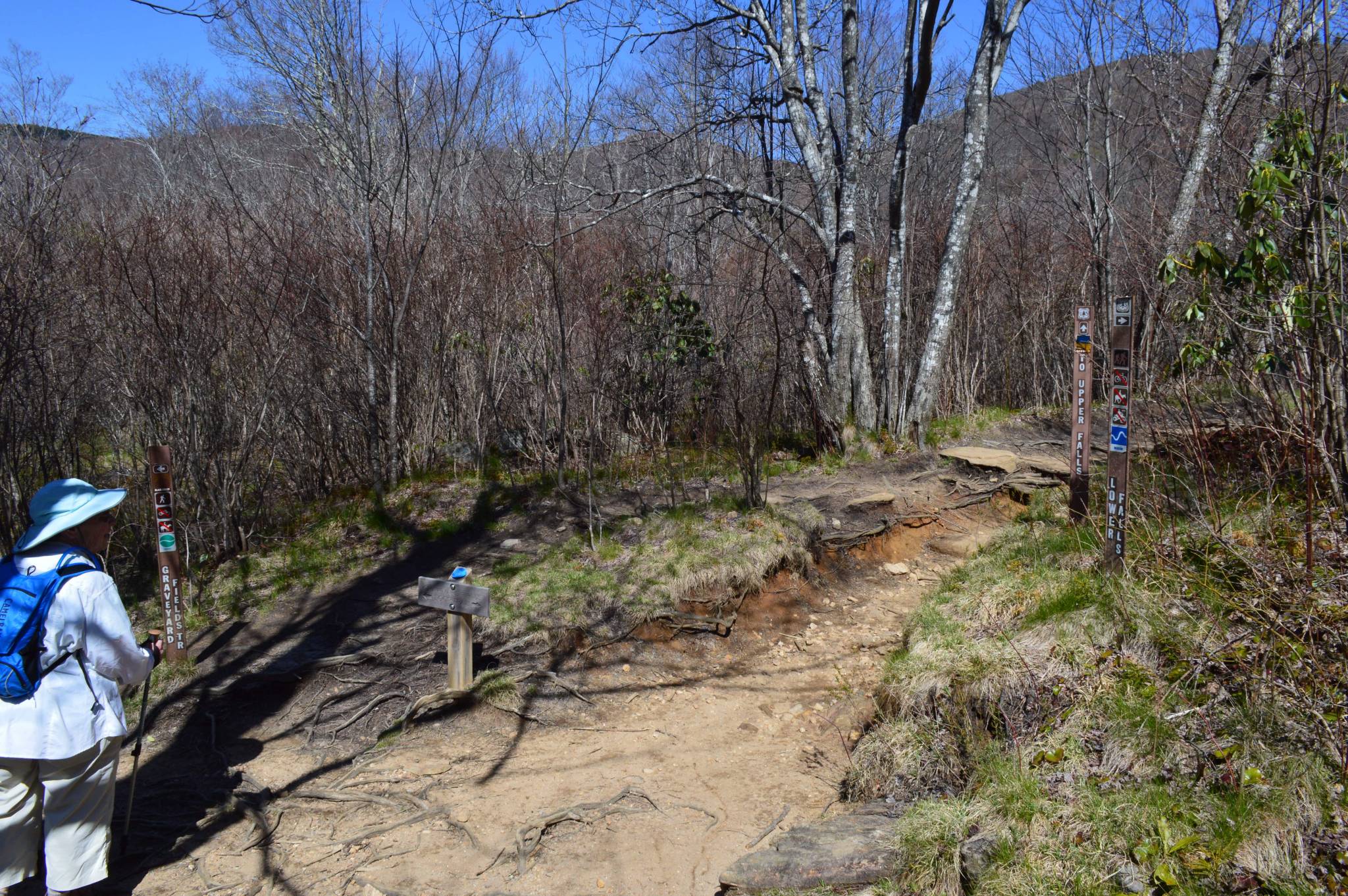
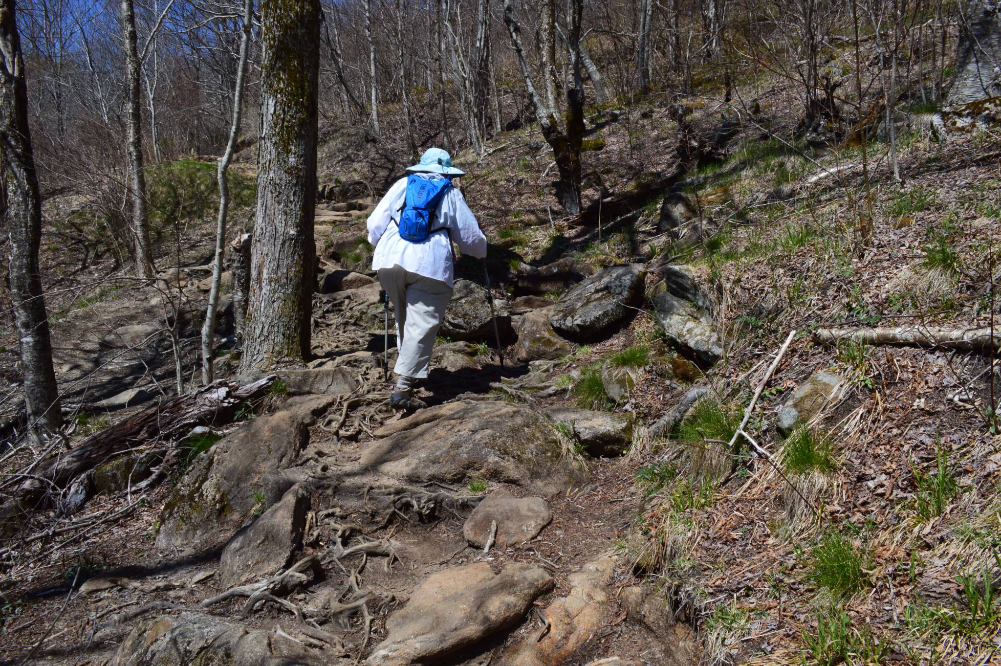
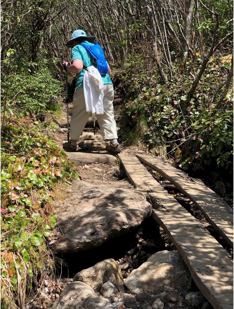
About 1.6 miles in from the trailhead, the split to the Upper Falls spur is well-marked. Little else beyond the split is marked. The Graveyard Fields Trail is rated “easy,” but much of this half-mile spur trail to the Upper Falls is steeper and rockier. There are several places where alternate paths have been worn as hikers have sought to avoid the wet and muddy main trail, and it can be difficult to be sure you’re on the correct trail at a couple of points.
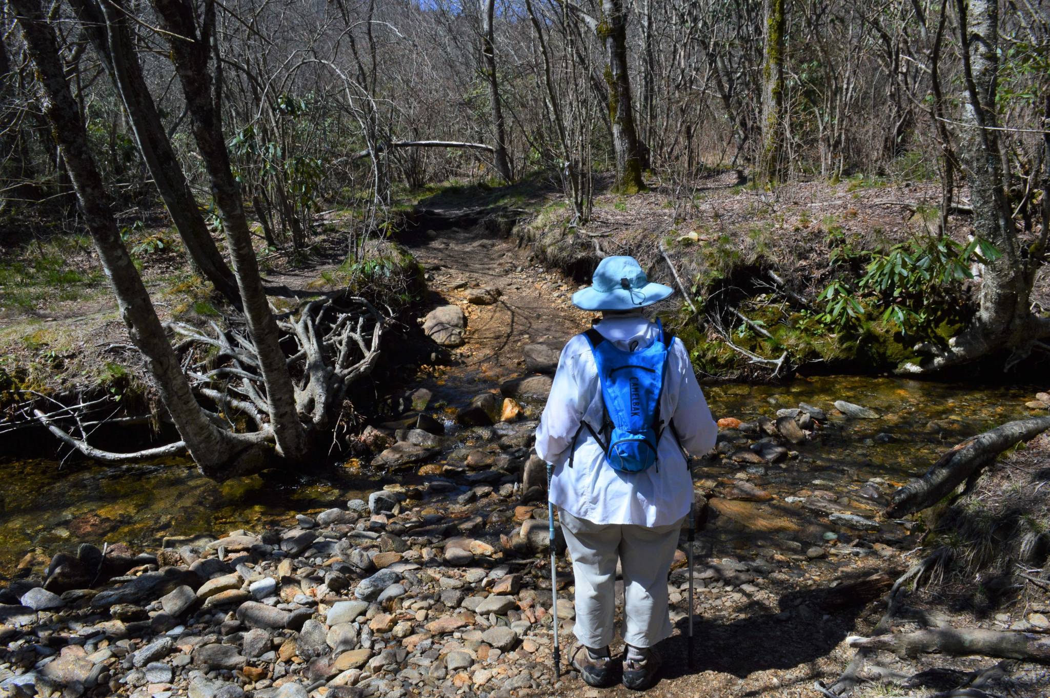
There is one relatively easy stream fording on the Upper Falls trail, as well.
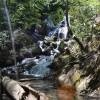
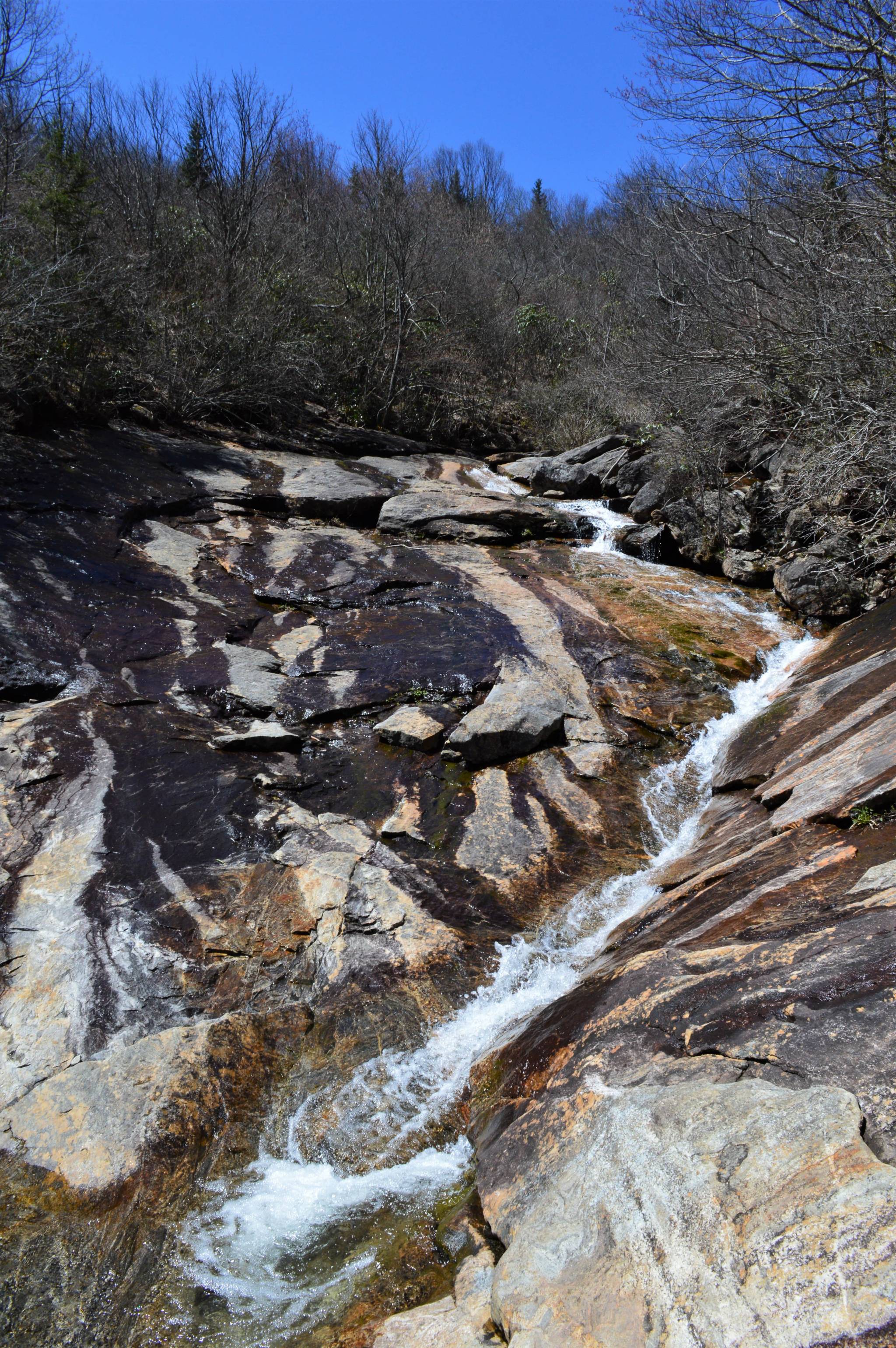
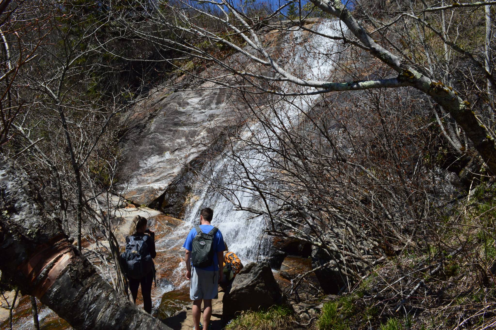
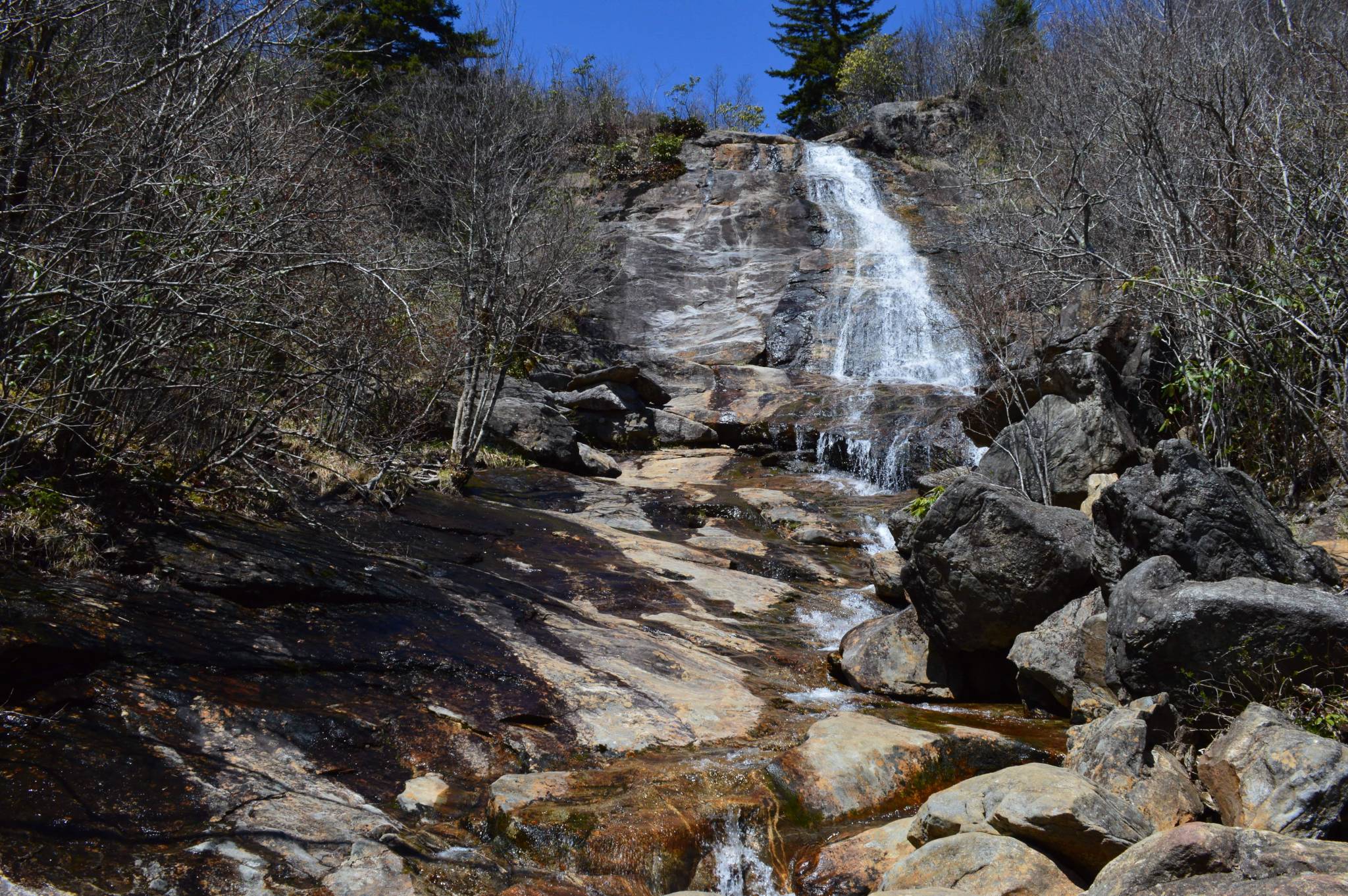
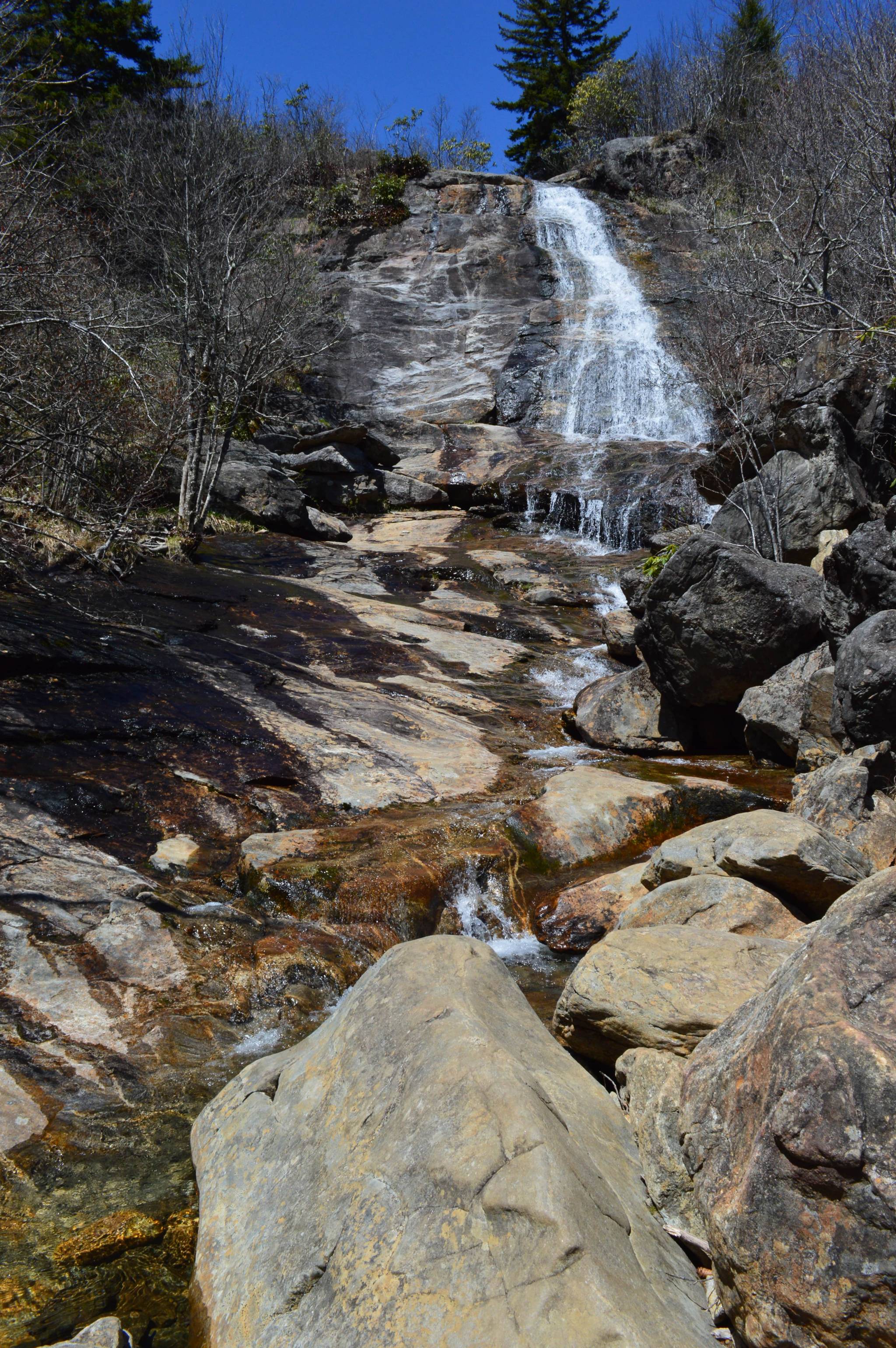
Eventually, to your left you’ll hear then see the cascade below the main waterfall. You’ll need to search around the rocks to find a clear view.
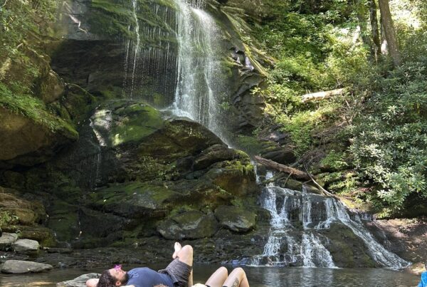
 Just a few dozen yards beyond the cascade, the trail comes to the base of Upper Falls. Once there, you’ll want to back-track a few yards to scramble out onto the rocks in the stream for a full view of the falls. (It’s not difficult.)
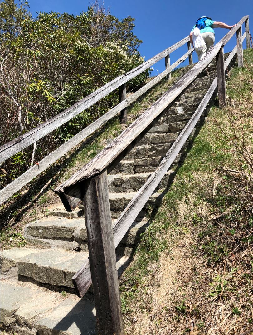
Once you make your way back to the Graveyard Fields loop, take a right and the trail works its way up, including over some parts that are easier than others, to the inevitable stairs to the parking lot.
Graveyard Fields is south of Asheville and the Mount Pisgah recreation area on the Blue Ridge Parkway.
Return to National Parks.
Visit Our Sister Site
Carolina Music Festivals, a calendar and guide to music festivals in North Carolina.