Devil’s Courthouse, Blue Ridge Parkway – Home – Parks & Forests – Camping – Hiking – Links – Adventures
Devil’s Courthouse
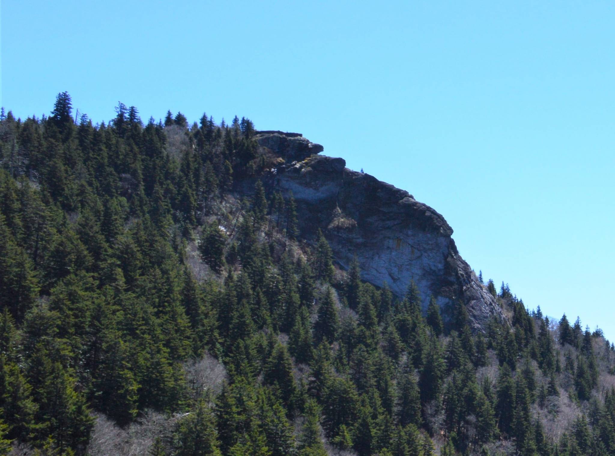
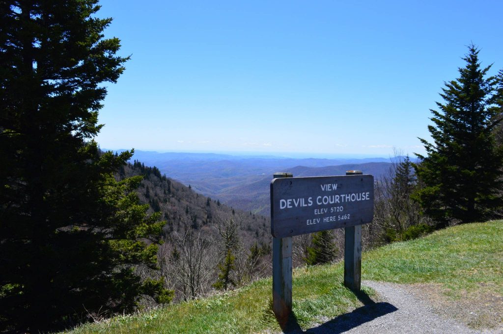
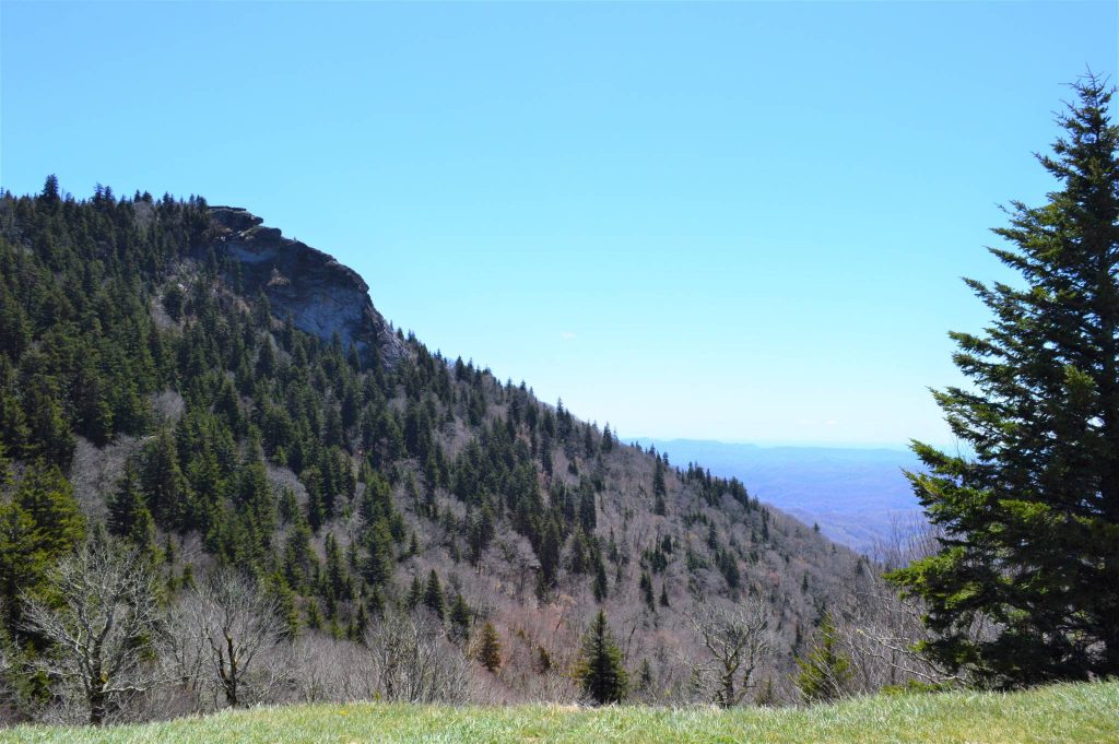
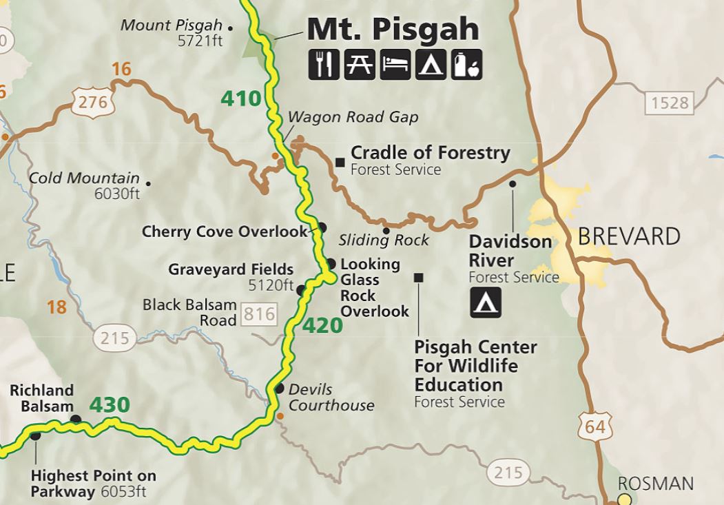
The Devil’s Courthouse is a large rock outcropping above a Blue Ridge Parkway overlook at Milepost 422.4, about 25 miles south of Asheville. In addition to views of the Pisgah National Forest below the Parkway, the Devil’s Courthouse stop offers a half-mile hike to the top of the rock for 360-degree views that stretch into three neighboring states.
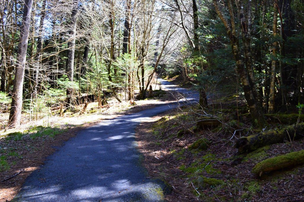
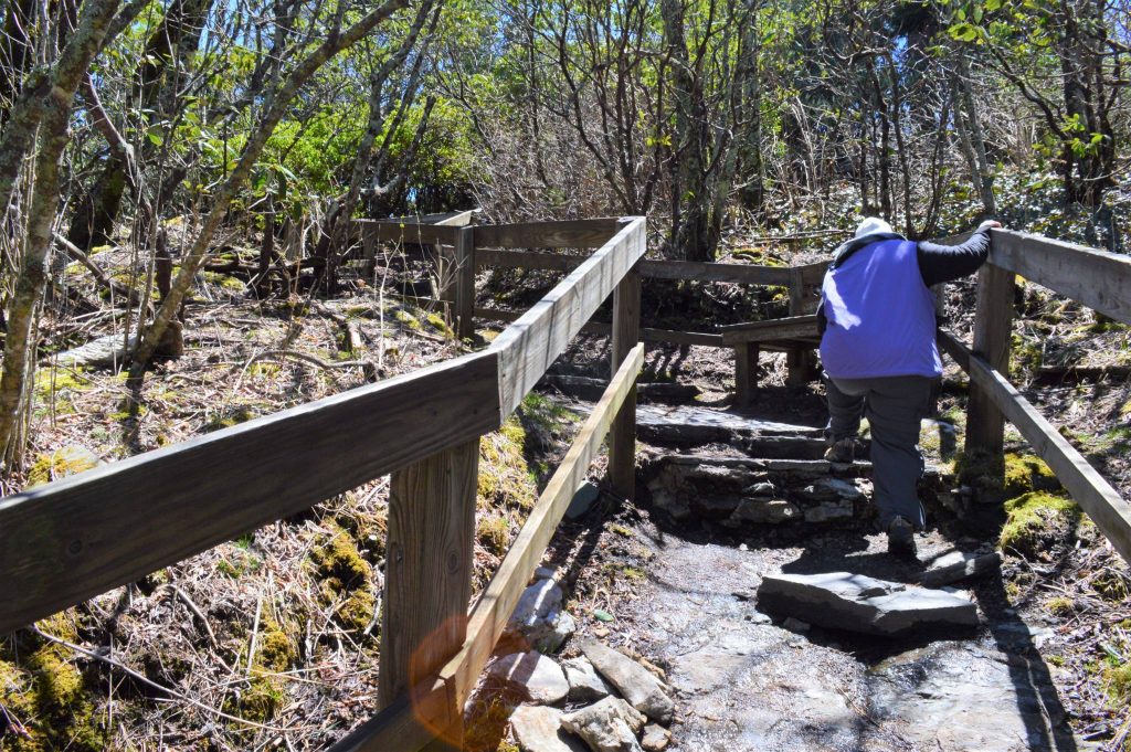
The hike is a 258-foot ascent that rates as moderately strenuous because it is steep and has some rocky parts. But just about anyone should be able to handle it. The trail and overlook were fairly crowded with hikers of all ages when we stopped there at the end of April 2021.
The name Devil’s Courthouse comes from a Cherokee legend that the evil spirit, Judaculla, held court inside the rock.
The out-and-back trail starts as a sidewalk that runs north from the Devil’s Courthouse parking lot alongside the Parkway for several yards and then turns to the right into the woods. The overlook is on your left if you are heading south from Asheville.
The trail’s first third of a mile is paved and offers a hearty warm-up as it courses upward through a forest of firs. There are a couple of benches along the way.
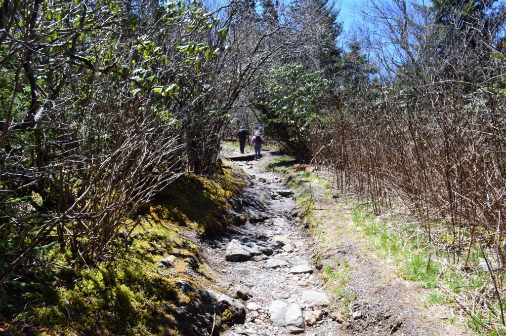
The trail splits at the end of the pavement, with a leg to the left joining the Balsams segment of the Mountains to Sea Trail. Heading to the right, the trail soon becomes rocky and rutted for a stretch before finishing with a set of stone steps with handrails that take you to the overlook.
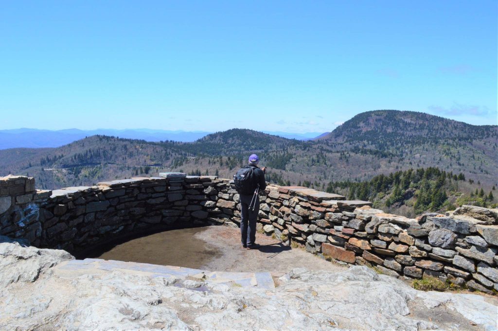
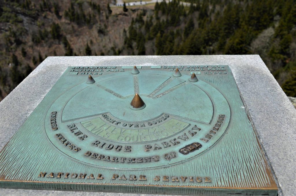
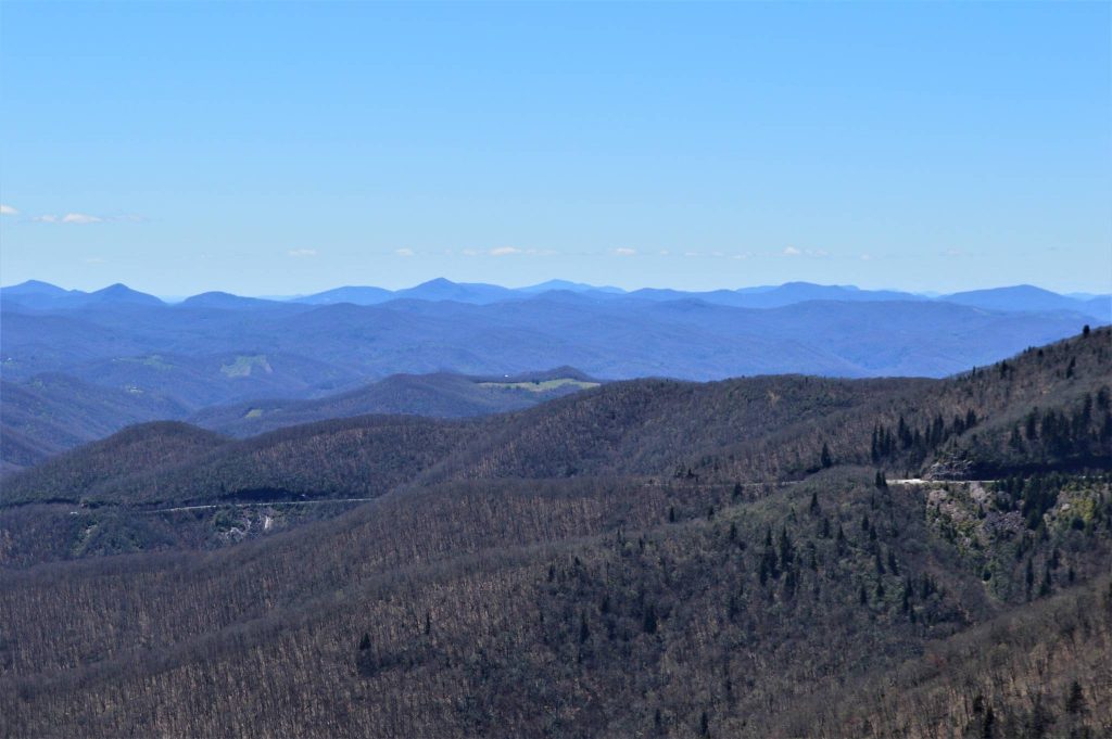
From atop Devil’s Courthouse on a clear day you can see into South Carolina and Georgia to the south and Tennessee to the west. Several viewfinders identify nearby mountains and other locations. The one below identifies Mount Hardy two miles to the south; Richland Balsam Mountain, the highest peak on the Parkway (elev. 6,410 feet), seven miles to the southwest; Snowbird Mountain, 35 miles away in Tennessee; and Sam Knob, two miles to the northwest. Shenandoah National Park 423 miles to the north in Virginia and Great Smoky Mountains National Park 47 miles to the south in North Carolina and Tennessee seem to be depicted on the wrong sides of the plaque.
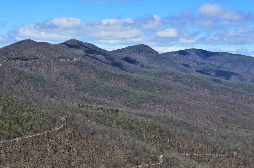
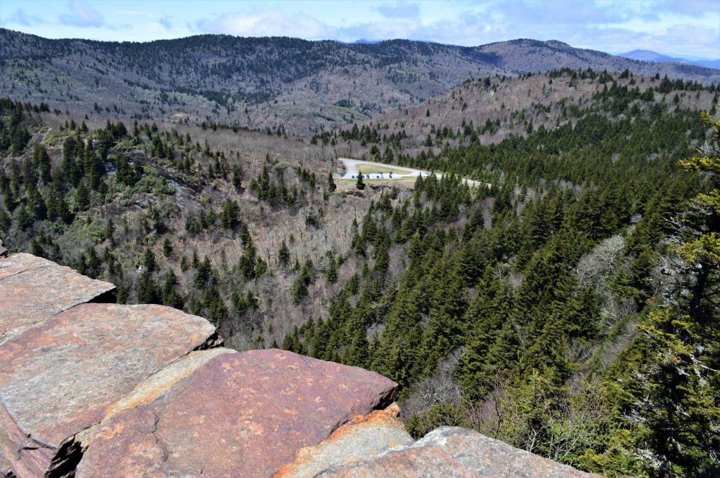
Here are a couple of views from atop Devil’s Courthouse, to the west first and then to the south and the parking lot below.
The Devil’s Courthouse overlook and trail is about 15 miles south of the Blue Ridge Parkway’s Mount Pisgah recreation area and about 3.5 miles south of the Graveyard Fields overlook and trails.
Return to National Parks.
Visit Our Sister Site
Carolina Music Festivals, a calendar and guide to music festivals in North Carolina.