Weymouth Woods Sandhills Nature Preserve
Renovations at Catawba Falls allow public access to the beautiful upper falls.
Carolina Outdoors Guide – Parks & Forests – Camping – Hiking – Adventures


National Wildlife Refuges exist primarily to safeguard wildlife populations through habitat preservation and, as such, offer prime opportunity to view or photograph birds and other wildlife. Other recreational opportunities vary, as do development and accessibility. Hunting, trapping and fishing are permitted on a NWR when compatible with the purposes for which the refuge was established and acquired. All state and federal regulations pertaining to hunting, trapping and fishing apply.
Several wildlife refuges in North Carolina are part of the Charles Kuralt Trail, which touches 11 refuges and the fish hatchery in Edenton and provides boardwalks, observation decks and nature trails.
The Mountain Bogs National Wildlife Refuge in the North Carolina and Tennessee mountains is not open to the public and is not listed below. As the refuge grows and the U.S. Fish and Wildlife Service acquires full ownership of additional parcels, it will work to develop public use opportunities, the FWS says.
After destructive storms, check at the links below to make sure sites are open.
Updated June 2025.
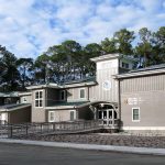
Coastal N.C. National Wildlife Refuges Gateway Visitor Center
 100 Conservation Way
Manteo, NC 27954
(252) 473-1131
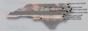
Locator Map
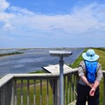
The visitor center serves as the gateway to the 11 National Wildlife Refuges in coastal North Carolina and southeastern Virginia, and the Edenton National Fish Hatchery. The center houses several state-of-the-art exhibits that represent a field trip to each refuge, an auditorium and a gift shop. There are also walking trails on site, and plans for gardens, a pavilion for educational programs and more on the grounds. Click on the photo for more information.
Alligator River NWR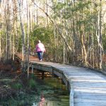
100 Conservation Way
Manteo, NC 27954
(252) 473-1131
Locator Map / Brochure & Refuge Map
Available for automobile touring, boating, fishing, hunting. Features two half-mile wheelchair-accessible nature trails: the Sandy Ridge Wildlife Trail, which is adjacent to 15 miles of paddle trails on Milltail Creek; and the Creef Cut Wildlife Trail, which also has a wheelchair-accessible fishing dock at its trailhead. The refuge has four paddling trails starting at the end of Buffalo City Road, where there’s a canoe/kayak launch and parking. Refuge Wildlife Drive offers opportunities to view a wide variety of birds, as well as black bears and red wolves. Main entrance is on U.S. 64, 12 miles east of Columbia across Alligator River in Dare County. Click on the photo for more information.
Cedar Island NWR
879 Lola Road
Cedar Island, NC 28520
(252) 225-2511
Locator Map / Brochure & Refuge Map
Available for boating, saltwater fishing, waterfowl hunting. The refuge is mainly a coastal marsh of 11,000; there are no formally designated trails, but visitors may hike along the refuge firebreaks and access roads. There are two boat ramps. Concentrations of diving ducks (lesser scaups, redheads, canvasbacks, buffleheads), sea ducks, American black ducks, black rails, wading birds and shorebirds. Refuge is approximately 40 miles northeast of Beaufort via U.S. 70 and N.C. 12 at the confluence of Pamlico and Core sounds in Carteret County.
Currituck NWR
316 Marsh Causeway
Knotts Island, NC 27950
(252) 429-3100
Locator Map
The refuge has no development but is open for hiking and waterfowl hunting. Home to concentrations of wading birds, shorebirds, waterfowl and raptors, plus a variety of mammals, reptile and amphibians. Piping plover and loggerhead sea turtles occasionally nest on the refuge. Refuge is 0.75 of a mile north of where N.C. 12 ends in Corolla. A four-wheel-drive vehicle is necessary to get to the refuge via the beachfront, and vehicles are restricted to the beach.
Great Dismal Swamp National Wildlife Refuge
3100 Desert Road
Suffolk, VA 23434
(757) 986-3705
Locator Map
Most of the refuge’s 111,000 acres of forested wetlands are in Virginia but a portion extends into Camden, Pasquotank and Gates counties in North Carolina west of U.S. 17. The refuge is available for boating and fishing, bird and wildlife watching and has several miles of road-trails for hiking or biking, plus a 1.5 mile TRACK trails loop for kids at the Portsmouth Ditch Trailhead. . Lake Drummond, a 3,100 acre natural lake in Virginia, is at the heart of the swamp and Lake Drummond Wildlife Drive is a six-mile self-guided drivable route. Refuge headquarters is approximately 1.6 miles from the intersection of Hosier Road and White Marsh Road (Route 642) off of I-337 and Va. 642 south of Suffolk. The southern reaches of the refuge are adjacent to North Carolina’s Dismal Swamp State Park.
Mackay Island NWR
316 Marsh Causeway
Knotts Island, NC 27950
(252) 429-3100
Locator Map / Brochure & Refuge Map
Available for bicycling, boating, fishing, hiking, hunting. Features a Charles Kuralt Trail observation site, an elevated platform with spotting scopes for views of the Great Marsh, plus seven miles of dikes suitable for walking or cycling. During fall and winter, tundra swan, ducks and large concentrations of snow geese congregate in the ponds south of the Great Marsh. Mackay Island is a portion of Knotts Island, which is accessible via private boat or free ferry at Currituck County Courthouse on N.C. 168 or via Princess Anne Road south from Pungo, Virginia. The refuge’s periodic Open Roads Days allow the public to drive the roads normally closed to vehicular traffic around the refuge impoundments at the end of Mackay Island Road. The refuge headquarters and Open Roads are located 1 mile and 6.2 miles, respectively, south of the N.C. state line on N.C. 615 and are marked by a large refuge sign.
 Mattamuskeet NWR
38 Mattamuskeet Road
Swan Quarter, NC 27885
(252) 926-4021
Locator Map / Tearsheet & Refuge Map
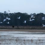
Available for automobile touring, boating, fishing, hiking, hunting. Lake Mattamuskeet (40,000 acres) is North Carolina’s largest natural lake. The refuge has significant wintering populations of ducks, Canada geese, snow geese and tundra swan. Concentrations of bald eagles and other raptors, wading birds and shorebirds occur seasonally. Features 3-mile entrance road and 5-mile drive along lake, and miles of grassed dikes criss-crossing the refuge. There are several observation decks and two state boat ramps. The refuge participates in the annual Wings Over Water festival each October. Plans to renovate the lakeside Mattamuskeet Lodge as an event center and museum have never come to fruition. The refuge is 9 miles east of Swan Quarter by U.S. 264 and N.C. 94 in Hyde County. Click on the photo for more information.
Pea Island NWR
 14500 NC Highway 12
Rodanthe, NC 27968
(252) 715-9697
Locator Map / Refuge Map
Available for boating, fishing, hiking. Features a visitor center, two wheelchair-accessible trails with an observation tower on one and an overlook on the other, a photography blind and 13 miles of beach. Concentrations of ducks, geese, swans, wading birds, shore birds, raptors, neotropical migrants are seasonally abundant on the refuge. On N.C. 12 north of Rodanthe on Hatteras Island in Dare County. Click on the photo for more information.
Pee Dee NWR
5770 U.S. 52 North
Wadesboro, NC 28170
(704) 694-4424
Locator Map
Available for automobile touring, fishing, hiking, hunting. The refuge’s 8,500 acres along the Pee Dee River provide habitat for more than 180 bird species, including wading birds, migratory waterfowl and songbirds. Enter the refuge 6 miles north of Wadesboro on U.S. 52 in Anson County.
Pocosin Lakes NWR
205 South Ludington Drive
Columbia, NC 27925
(252) 796-3004
Locator Map
Available for automobile touring, fishing, hiking, and deer and small game hunting. Features the Walter B. Jones Sr. Center for the Sounds interpretive visitors center, the half-mile accessible Scuppernong River Interpretive Boardwalk and additional trails, the Red Wolf Center, and observation and photography opportunities for tundra swan, snow geese and ducks, as well as black bear and other birds and animals. The approximately 44 miles of dirt roads on the refuge’s Pungo Unit are the most popular for wildlife observation. The Pungo Unit can be accessed 18 miles south of Plymouth, NC, at the intersection of N.C. 45, Pat’s Road, and Refuge Road. There is an informational kiosk with maps of the unit.
Roanoke River NWR
114 West Water Street
Windsor, NC 27983
(252) 926-4021
Locator Map / Brochure & Refuge Map
Available for fishing, boating, hiking, hunting. Concentrations of wintering waterfowl, nesting ducks, raptors, osprey and neo-tropical migrants are common. The largest inland heron rookery in North Carolina is on the refuge. Bald eagles nest on adjacent lands; river corridor is wintering area for bald eagles. The refuge consists of five tracts of land along 70 miles of the Roanoke River and two distant satellite tracts in other river basins. The Kuralt Trail is a 0.65 mile one-way gravel-surface trail, and the dirt Conine North and Askew East and West roads on either side of U.S. 13/17 are also open for hiking and walking. Main office is off U.S. 17 (Water Street) near the intersection with King Street in Windsor, in Bertie County.
Swanquarter NWR
c/o Mattamuskeet NWR
38 Mattamuskeet Road
Swan Quarter, NC 27885
(252) 926-4021
Locator Map
Available for motorized boating, saltwater fishing, waterfowl hunting. Concentrations of diving ducks (lesser scaups, redheads, buffleheads, canvasbacks, and surf scoters), sea ducks, American black ducks, wading birds and shorebirds. The refuge supports one of the northernmost populations of the American alligator. There are four boat ramps (one accessible only via a trail), and a fishing pier at Bell Island. Refuge land on the north shore of Pamlico Sound east and west of the village of Swan Quarter is only accessible by boat, except for trails in the Bell Island Unit (2 miles west of Swan Quarter by U.S. 264) in Hyde County.
Carolina Music Festivals, a calendar and guide to music festivals in North Carolina.
More results...
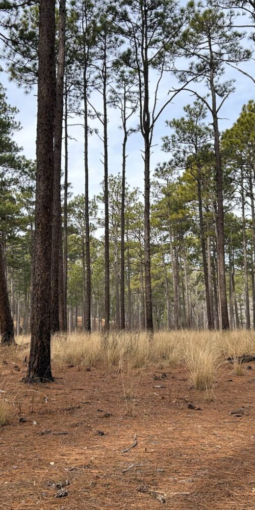 Weymouth Woods Sandhills Nature Preserve
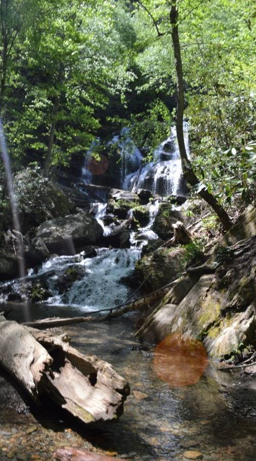
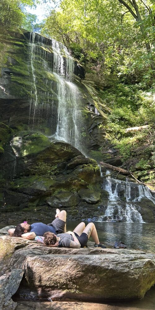 Catawba Falls, Pisgah National Forest
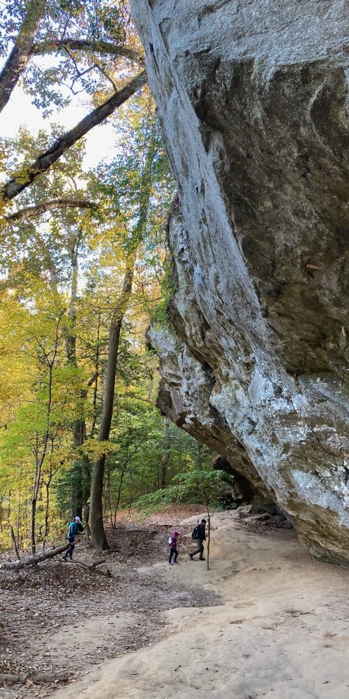 Raven Rock State Park, Lillington, North Carolina
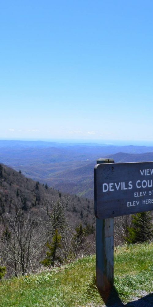 Devil’s Courthouse, Blue Ridge Parkway
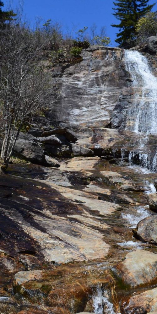 Graveyard Fields & Upper Falls, Blue Ridge Parkway
 Gorges State Park to Offer Family Campground and Cabins
 Catawba Falls Trail Closes for Work Toward Expanded Access
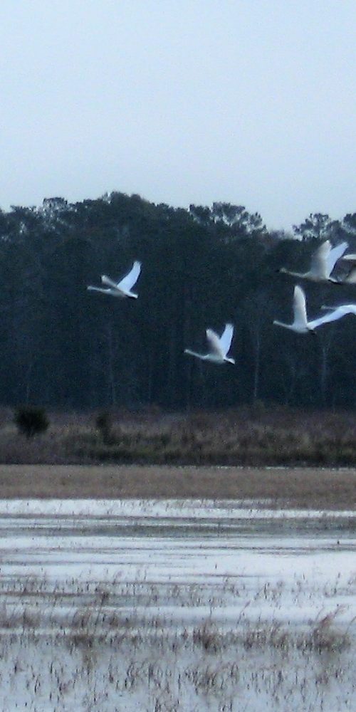 Mattamuskeet National Wildlife Refuge