Max Patch – Home – Parks & Forests – Camping – Hiking – Links – Adventures
Max Patch
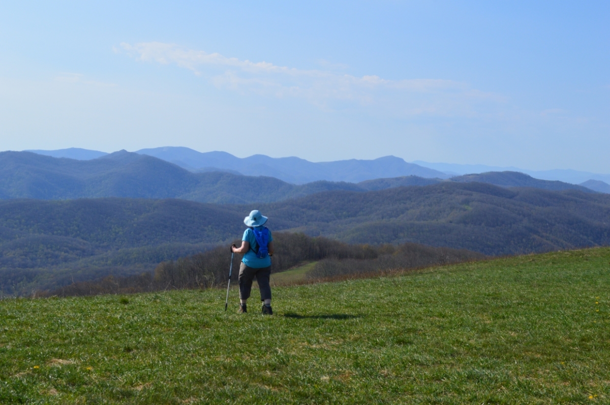
Max Patch is an iconic, grassy bald near the North Carolina-Tennessee border reached by an easy hike up the last bit of the mountain from a Forest Service parking lot or via the Appalachian Trail, which crosses the bald. At the 4,629-foot summit, the hiker is rewarded by a large expanse and a 360-degree view of the mountains beyond.

On a clear day, you might see Mount Mitchell, the tallest peak east of the Mississippi (elev. 6,683 feet), to the east, where Pam looks above, and peaks of the Great Smokies to the south, below.
We visited Max Patch on a beautiful but windy Friday morning in May 2018 while in Hot Springs for the French Broad River Music Festival. The day use site is open year-round, and around the clock. We saw evidence of several campfires, as well as one family who had apparently spent the night.

- See restrictions, including a ban on camping, imposed at Max Patch in July 2021.
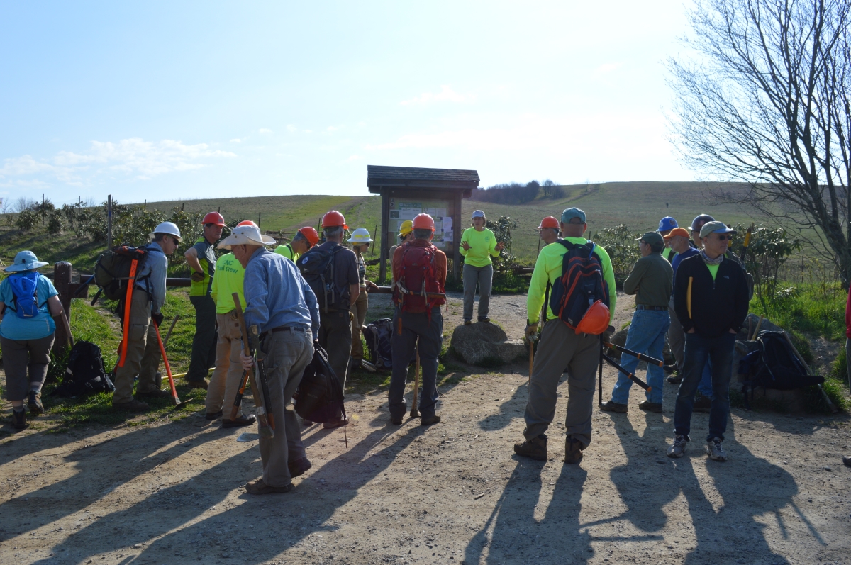
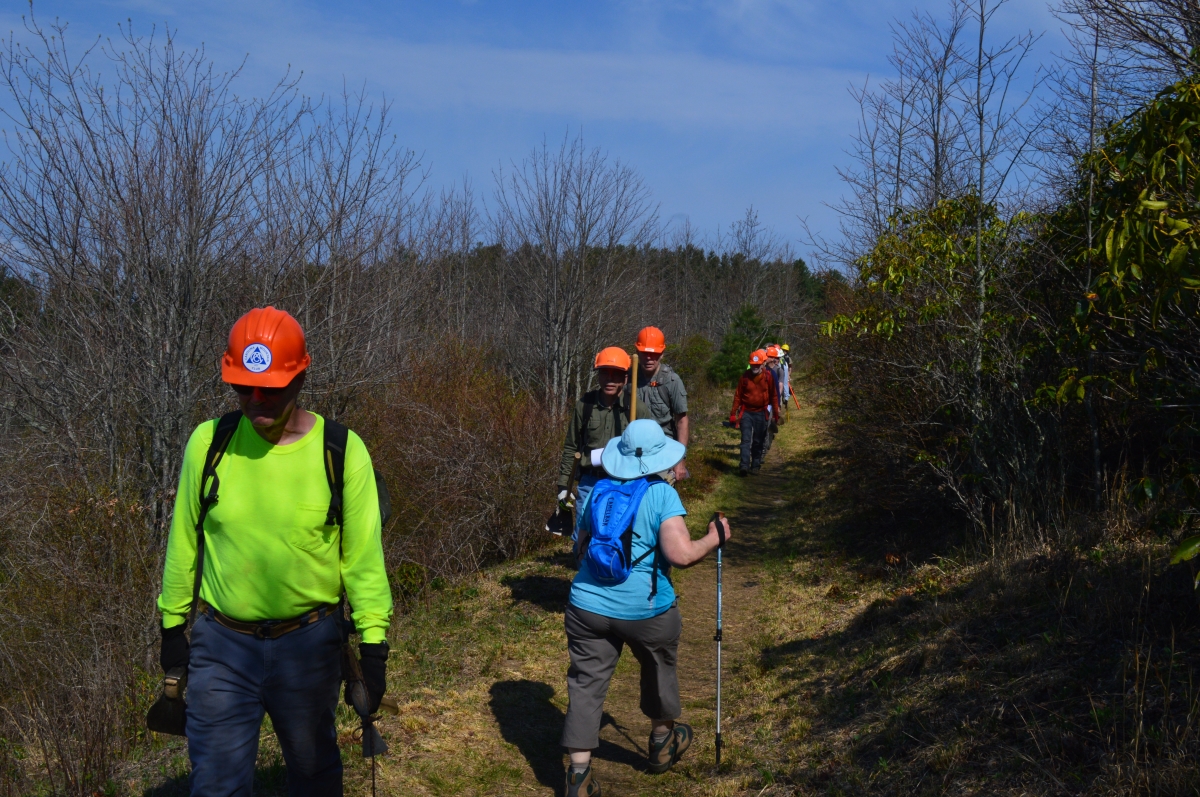
Max Patch was cleared in the 1800s to create a pasture for sheep and cattle. Several sources say there was a landing strip at Max Patch in the 1920s for planes offering sight-seeing rides. Today, the National Forest mows and conducts prescribed burns to maintain the site and, as we saw, volunteers help maintain the trails.
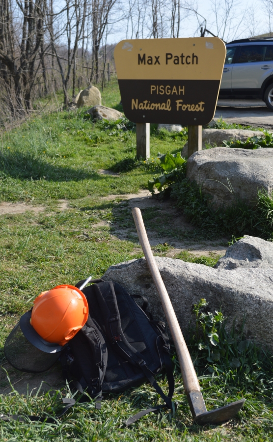
Members of the Carolina Mountain Club were out for a trail work day when we visited Max Patch.
The legs of the loop that head up the hill to meet the AT run right and left from the parking lot, creating a 1.4-mile loop. The Max Patch Loop Trail, providing a 2.4 mile hike, runs off of the more difficult route to the right and circles the mountaintop. The sign below is at the split.
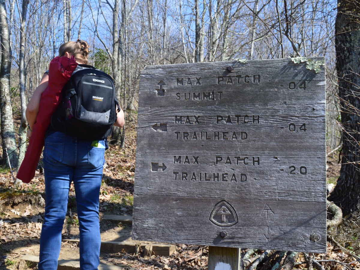
The route to the summit (including the AT) is .8 miles if pursued to the right at the parking lot and .6 miles to the left.

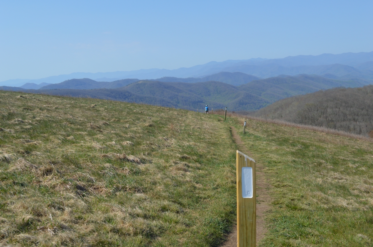
It is an easy climb on a wide trail flanked by hardwoods and the occasional rhododendron, neither of which had heard about the arrival of spring.

Once the summit access trail meets the AT, it’s just a little ways up to the summit on the well-worn and well-blazed national scenic trail.

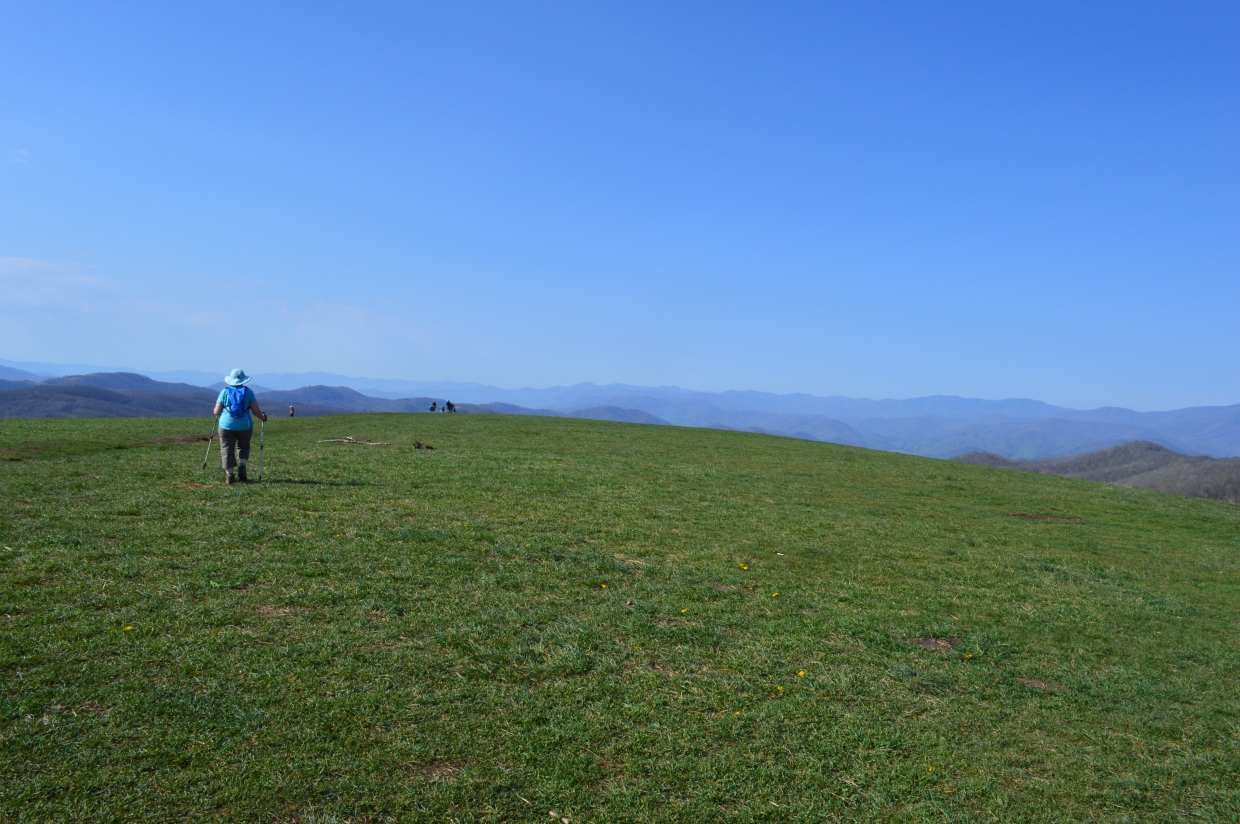
Notice one of the campers on the ridge in the upper right …

Here’s a scan of the famous 360-degree view at Max Patch, which starts facing north-northeast:
When it’s time to leave (let’s face it, most people take the easier route up and the harder down), the AT’s iconic white blaze makes the proper route unmistakable.
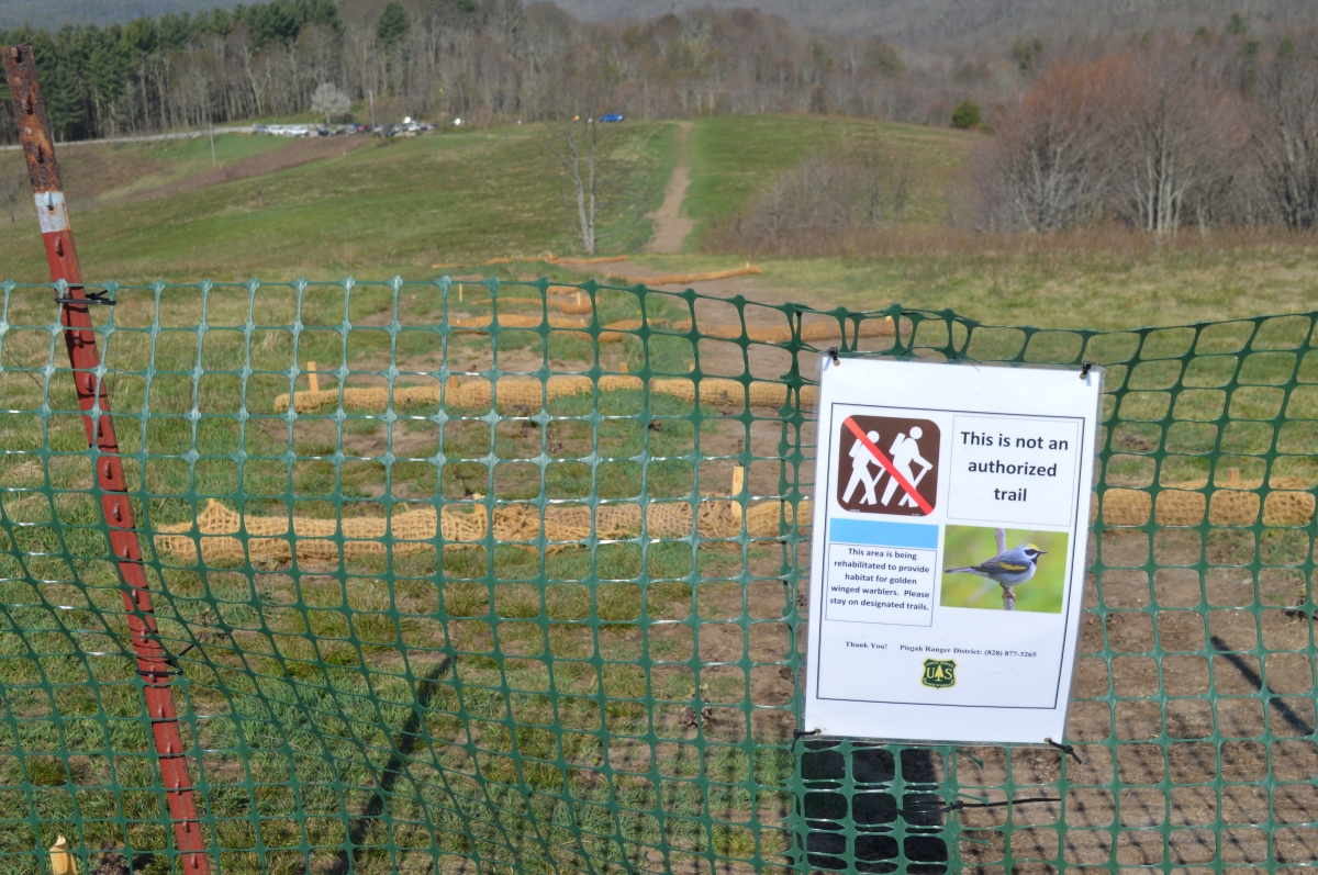
Still, some folks have their own ideas about shortcuts. We don’t know about golden winged warbler habitat, but it’s not hard to figure how quickly and badly a path straight down the hill will erode. Stay on the marked trail.
The more difficult side of the summit loop is indeed steeper.

But it’s a quick descent, and once you rejoin the summit access/Max Patch Loop, the trail is broader and flatter, though not as wide as on the way up the other side of the hill.
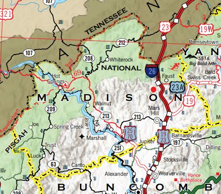
To get to Max Patch from Hot Springs, take NC 209 south for 7.3 miles to Meadow Fork Road (SR 1175). Turn right onto SR 1175 for 5.3 miles, then take a left onto Little Creek Road (SR 1181) and go about 3.5 miles to a dirt/gravel road. Turn right on SR 1182 for 1.5 miles, which will bring you back to the dirt road. Once on the dirt road, keep turning right on your way up the mountain.
There’s also a small fishing pond a quarter-mile down and around the bend from the Max Patch parking lot. A Madison County tourism site says it is usually rapidly fished out after it is stocked.
Return to National Forests.
Visit Our Sister Site
Carolina Music Festivals, a calendar and guide to music festivals in North Carolina.