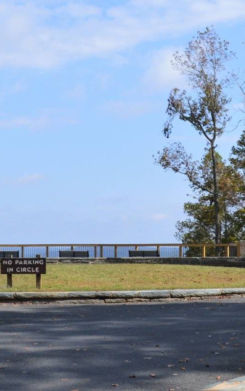
Devil’s Courthouse, Blue Ridge Parkway
Devil's Courthouse offers a short hike to 360-degree views into three neighboring states
Carolina Outdoors Guide – Parks & Forests – Camping – Hiking – Adventures


Just about any site we list on our parks and forests pages has some kind of walking trail. There are numerous hiking opportunities on National Parks properties in North Carolina, particularly in the mountians.
For our Hiking pages, we list trails that are generally 5 miles or longer. We’ve provided links to maps and some additional information where it’s available.
Trail names, lengths and difficulty levels may differ among publications. Check at park offices or ranger stations for maps and guides.
For the definitive guide to hiking in North Carolina, we recommend “North Carolina Hiking Trails” by Allen de Hart, which is a source for some of the information below.
Also, Joe Miller, the former outdoors/fitness reporter for The News & Observer in Raleigh, has published “100 Classic Hikes in North Carolina” and “Backpacking North Carolina.”
And, specifically for the Blue Ridge Parkway (below), there’s Randy Johnson’s “Hiking the Blue Ridge Parkway.” and “Best Easy Day Hikes of the Blue Ridge Parkway,” among his other books about hiking in North Carolina.
After destructive storms, check at the links below to make sure sites are open.
Updated August 2025.
Appalachian National Scenic Trail
Appalachian Trail Park Office
P.O. Box 50
Harpers Ferry, WV 25425
(304) 535-6278
(Interactive Maps)
The National Park Service does not currently have a visitor center. The Appalachian Trail Conservancy, a national nonprofit organization, operates its own visitor center in Harpers Ferry, West Virginia.
Appalachian Trail Conservancy
799 Washington Street
Harpers Ferry, WV 25425
(304) 535-6331
(Interactive Map)
The 2,181-mile Appalachian Trail runs from Springer Mountain in Georgia to Mount Katahdin in Maine. There are about 300 miles of the trail in North Carolina or along the North Carolina/Tennessee border between Bly Gap in Clay County (8.6 miles north of U.S. 76 in Georgia) and Elk Park on U.S. 19E in Avery County. With more than 500 access points, the entire trail covers six units of the National Park Service, eight national forests and 60 state parks and forests. The AT allows primitive camping and has three-sided shelters located at varying intervals along the trail. In national parks, such as Great Smoky Mountains National Park in North Carolina and Tennessee, permits are required for all overnight stays in the backcountry.
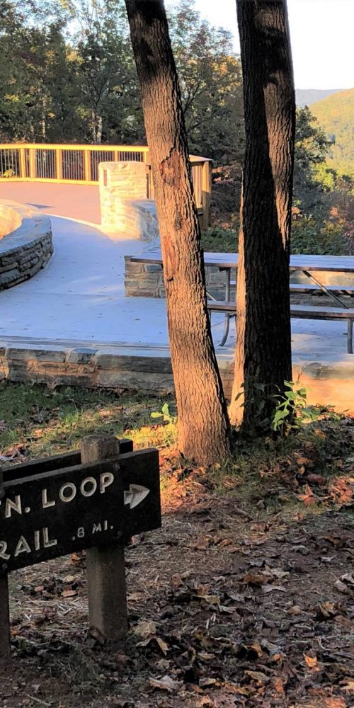
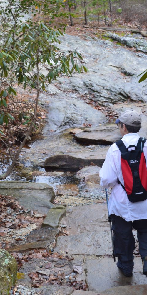
There are more than 70 trails along the Blue Ridge Parkway in North Carolina, from leg stretchers of as little as one tenth of a mile to hikes of several miles.
Parkway Map
Doughton Park Area
– Bluff Mountain Trail. Milepost 238.5 to MP 244.7 parallel to Parkway. Moderate, 7.5 miles. Many scenic vistas along relatively level terrain.
– Grassy Gap Fire Road. MP 243.7 Moderate, 6.5 miles. Trail is also open to horseback riding.
– Flat Rock Ridge Trail. MP 244.7 Moderate, 5 miles. Begins on the mountain-top meadow at Basin Cove Overlook and ends on the banks of Basin Cove Creek.
Julian Price Park/Grandfather Mountain Area
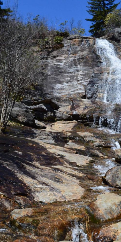
– Boone Fork Trail. Milepost 296.4, at Julian Price Memorial Park picnic area. Moderate, 5.5-mile loop; a portion of the trail is part of the Mountains-to-Sea State Trail. Hike mostly along Boone Fork creek also passes through shaded rhododendron-filled woods, meadows, large rock out-crops and Hebron Falls. 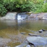 Click on the photo for a video of Hebron Falls.
– Tanawha Trail. MP 297 to 305.5 parallel to Parkway. Moderate/strenuous, 13.5 miles. The trail runs from Julian Price Park to Beacon Heights, passing Grandfather Mountain, numerous other scenic sites and below the Linn Cove Viaduct.
Moses Cone Park/Grandfather Mountain Area
Cone Park (Milepost 294) offers 25 miles of gently sloping carriage roads surrounded by formal plantings of rhododendron and mountain laurel and featuring apple orchards and an apple barn, Bass Lake and a maze. Carriage roads are also open to horseback riding and cross-country skiing.
Linville Falls Area
– Big Butt Trail. MP 359.8 Strenuous, 6.2 miles (mostly on National Forest land).
Craggy Gardens Area
– Douglas Falls Trail. MP 363.4 Strenuous, 8 miles (round trip). The trail winds past a series of cascades and two virgin hemlock groves before reaching the 70-foot Douglas Creek Falls.
 – Mountains-to-Sea State Trail. Segment of the MST crosses the park from MP 382 (Folk Art Center) to MP 359.8 (Balsam Gap (North)). Moderate/strenuous, 22.7 miles in Craggy Gardens area.
– Snowball Mountain Trail. MP 367.6 Moderate to strenuous, 8 miles. Trail passes through a mixed-hardwood forest and follows the ridges to provide views on both sides, including from Snowball Mountain and Hawkbill Rock above the Reems Creek Valley.
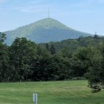
Click on the photo for a look at the 1.3-mile Mount Pisgah Trail on the Blue Ridge Parkway.
Cape Hatteras National Seashore
– Mountains-to-Sea State Trail. The final leg of the MST, Segment 18, runs 82 miles from the Cedar Island ferry terminal on Ocracoke Island to Jockey’s Ridge State Park in Nags Head on Bodie Island. Most of this segment of the trail is on loose, sandy beaches and includes a ferry ride and hiking along the shoulder of N.C. 12.
Great Smoky Mountains National Park
The Great Smoky Mountains National Park has more than 850 miles of trail on more than 500,000 acres of land in North Carolina and Tennessee (trail map). A portion of the Appalachian Trail and 93 miles of the Benton MacKay Trail cross the park. GSMNP trails often connect and cross each other, offering extended hikes and looping routes. Horseback riding is allowed on many trails.
The park’s hiking page at the link above lists five popular destination hikes in the park, including:
– Hike to Charlies Bunion, an 8-mile trek (roundtrip) on the Appalachian Trail accessed at Newfound Gap Overlook on U.S. 441/Newfound Gap Road. The hike features panoramic mountain views and a unique rocky outcrop surrounded by steep cliffs.
– Hike to Rainbow Falls, a 5.6-mile hike (roundtrip) with an approximately 1,500 foot elevation gain from the trailhead to the 80-foot falls, the highest single-drop waterfall in the park. This trail is also a hike to Mount LeConte, which is 6.7 miles from the trailhead. Access the trial at the Rainbow Falls Trailhead on Cherokee Orchard Road.
Below are some additional trails of 5 miles or more grouped around forecountry campgrounds, for which general directions are given, except for the North Shore Area and the Twentymile Creek Area. The North Shore Area represents the northern shore of Fontana Lake and is accessible by a road at either end. There is a ranger station at Twentymile Creek. The trailhead for each trail listed is at or near the campground, ranger station or the road at either end of Fontana Lake.
Balsam Mountain Campground (Caldwell County, on Heintooga Ridge Road off the Blue Ridge Parkway at MP 458.2) (Locator Map)
– Balsam Mountain Trail. Moderate/Strenuous, 10.1 miles.
– Rough Fork Trail. Strenuous, 6.4 miles. Other end of trail is in Cataloochee Area.
– Hemphill Bald Trail. Strenuous, 8.5 miles.
Big Creek Campground (Haywood County, near Waterville, off I-40 at exit 451 in Tennessee) (Locator Map).
– Big Creek Trail. Moderate, 5.3 miles.
– Baxter Creek Trail. Strenuous, 6.2 miles.
Cataloochee Campground (Haywood County, near Cove Creek Gap, off I-40 at exit 20) (Locator Map).
– Pretty Hollow Gap Trail. Strenuous, 5.6 miles.
– Cataloochee Divide Trail. Moderate, 6.4 miles.
– Caldwell Fork Trail. Moderate, 6.3 miles.
– Little Cattalooche Trail. Moderate, 5.1 miles.
– Rough Fork Trail. Strenuous, 6.4 miles. Other end of trail is in Balsam Mountain Area.
 Smokemont Campground (Swain County, on U.S. 441, approximately 7 miles north of Cherokee) (Locator Map)
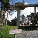
– Mountains to Sea State Trail. The start of the MST is Segment 1, which runs 46.8 miles from Kuwohi (Clingmans Dome), the highest point in GSMNP, to Waterrock Knob on the Blue Ridge Parkway. Click on the photo for more about Kuwohi and GSMNP.
Deep Creek Camground (Swain County, north of Bryson City) (Locator Map)
– Deep Creek Trail. Strenuous, 10.9 miles. Including 2-mile Deep Creek Horse Trail.
– Thomas Divide Trail. Strenuous, 13.3. Horseback riding allowed on portion of trail.
– Noland Divide Trail. Strenuous, 11.5.
North Shore Area (Swain County, north of Fontana Lake, accessible via Lakeview Drive from Bryson City (Locator Map) or off N.C. 28 at Fontana Dam (Locator Map)
– Hazel Creek Trail. Strenuous, 14.7 miles. (Off of Lakeshore Trail in Fontana Dam area)
– Jenkins Ridge Trail. Strenuous, 8.9 miles. (Off of Hazel Creek Trail)
– Noland Creek Trail. Strenuous, 10.2 miles. (Lakeview Drive)
– Lakeshore Trail. Easy to Strenuous, 33.5 miles. (Lakeview Drive to Fontana Dam area)
– Eagle Creek Trail. Strenuous, 8.7 miles. (Fontana Dam area)
Twentymile Creek Area (Swain County, on N.C. 28 about 6 miles west of Fontana Village) (Locator Map)
– Twentymile Trail. Strenuous, 5 miles.
– Wolf Ridge Trail. Strenuous, 6.3 miles.
Overmountain Victory National Historic Trail
2635 Park Road
Blacksburg, SC 29702
(864) 936-3477
The Overmountain Victory Trail commemorates the campaign leading to the Revolutionary War battle of Kings Mountain by following the route of Patriot militia men from Virginia, Tennessee, North Carolina and South Carolina to the battle site at Kings Mountain National Military Park, South Carolina. The 330-mile length of the trail is under development with more than 50 miles now accessible.
Segments in North Carolina include:
– Elkin Muster Grounds, Elkin. 2 miles of certified OVNHT wind through Elkin Municipal Park and through private property easements.
– Yadkin River Greenway, Wilkesboro. Although not yet connected, all sections of greenway that are adjacent to the river are certified sections of the OVNHT About 4.25 miles.
– W. Kerr Scott Dam and Reservoir, Wilkesboro. 11 miles of certified OVNHT are primarily mountain biking trails but hikers are welcome.
– Gillespie Gap (NC Minerals Museum), Spruce Pine. Two certified sections of OVNHT available to walk: a 1.8 mile section up the hill behind the museum, and a 1.2 mile section of trail across the road from the museum.
– Rose Creek Trail/Hefner Gap, Blue Ridge Parkway. 1.5 miles; trailhead is across the road from the Hefner Gap Overlook parking area (Milepost 325.9).
– Trail No. 308 & Road No. 1238, Pisgah National Forest. About 1.75 miles of trail along the Mountains to Sea State Trail where the MST meets Old NC Highway 105, also known as Road No. 1238.
– Lake James/Paddy’s Creek, Nebo. 2.3 mile certified section of OVNHT at Lake James State Park.
– Catawba River Greenway, Morganton. 4.8 miles between the Rocky Ford Access and Catwaba River Soccer Complex in Morganton.
– Purple Martin Greenway, Rutherfordton. 3 miles (expansions are planned) of paved trail that are bicycle and stroller friendly.
Carolina Music Festivals, a calendar and guide to music festivals in North Carolina.
More results...
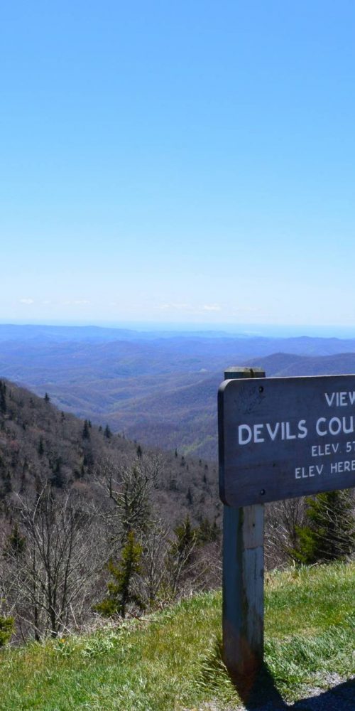 Devil’s Courthouse, Blue Ridge Parkway
 Graveyard Fields & Upper Falls, Blue Ridge Parkway
 Morrow Mountain State Park, Albemarle, N.C.
 Three Rivers Trail, Morrow Mountain State Park
 Quarry Trail, Morrow Mountain State Park
 Morrow Mountain Trail, Morrow Mountain State Park
 N.C. State Parks Leading New Year’s 2020 First Day Hikes
 Land Next to Popular Croatan Forest Nature Trail Protected